Any useful resources relating to Emsworth Yacht Harbour can be found here, including Site Maps, Tide Gauges, Timetables & Tide Information, as well as links to interesting projects and associations.
Tide Gauge & Tide Timetables
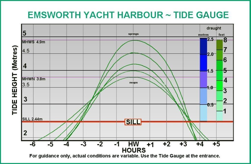
Tide Gauge
Our marina has a fixed sill at the entrance. This chart can be used as a tool to help calculate your ability to access the marina at different states of tide. Whilst this chart provides a very useful estimate, it is most accurate to check the depth over the sill against the Tide Gauge when approaching the marina entrance. You can also check the tide height over the sill live using our webcam, The webcam displays the tide height over our drying grid, which is exactly the same as the tide height over our sill.
Tide Timetables
Click the buttons below for a PDF of our tide tables for the year for Emsworth, or to access the National Tidal and Sea Level Facility website for tidal predictions covering the next month in Portsmouth. Versions of the Emsworth tide tables are also available from the Harbour Office.
Feel free to contact us if you need any help interpreting the information presented in these tide resources – Email us at info@emsworth-marina.co.uk or call the office during opening hours on 01243 377727
Site Map of Emsworth Yacht Harbour
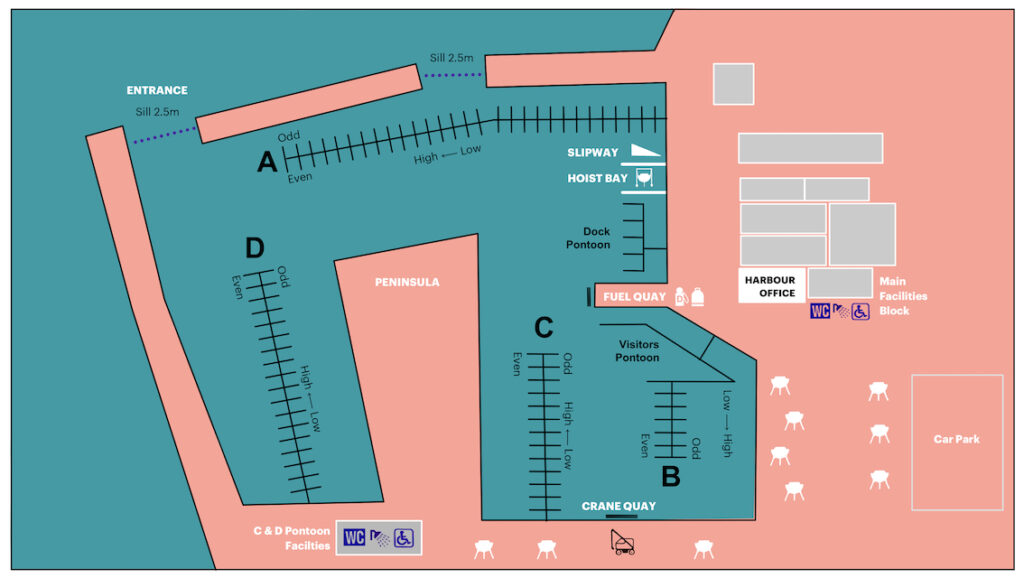
Our Site Map shows the layout of our main facilities and pontoons at Emsworth Yacht Harbour. You may find this useful to refer to if you are visiting the marina and wish to locate your berth – Note that each side of every pontoon is labelled with either ‘Odd’ or ‘Even’ berth numbers.
Click here for a full-size image of the map:
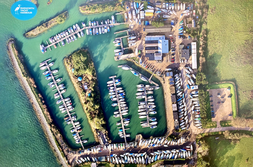
Bird’s-eye view photograph of Emsworth Yacht Harbour.


